
New technological advancements are driving operational efficiencies, opportunities to enhance infrastructure, and additional methods to ignite growth for both developing and developed countries. Integrating BIM with geospatial data has created such new opportunities, both on macro and micro level. Placing intellectual capital and building design decisions, both old and new, in the context of spatial intelligence has not only revolutionized infrastructure planning, but also development and maintenance.
Continuously increasing computer power in combination with the availability of inexpensive data acquisition methods and automated workflows that generate detailed 3D data have caused GIS models to become more sophisticated, now including detailed models of individual buildings – traditionally a siloed domain of BIM.
The same increase in computing power, together with the availability of better software, has enabled the application of BIM methodologies on a large scale, ultimately helping to solve one of the biggest hurdles to GeoBIM; the ability to import old CAD building designs into a new, geospatially integrated, BIM (Building Information Model).
Automating the Gap Between CAD Drawings and a Geo-Enabled BIM through Revit
Transitioning legacy CAD drawings to a geo-enabled BIM Model has not only long been considered the biggest hurdle to a true enterprise geo-enabled BIM but has, in addition, been a cost-prohibitive and substantial roadblock to true BIM acceptance across municipalities and governments.
As easy as it may be to mandate that all new buildings and constructions adhere to a modern BIM format, such as Revit, evolving legacy architectural floor plans and drawings to an immersive, analytic-ready, BIM environment remained an onerous task without a clear solution in sight.
With the help of innovative technology, process expertise, and proprietary development, Avineon has automated the process of loading both foundational/architectural and MEP (Mechanical, Electrical, and Plumbing) elements of legacy CAD drawings into a geo-enabled BIM. Avineon’s cutting-edge process to convert 2D CAD plans to 3D BIM at scale, as illustrated in figure 1, and subsequent migration into GIS enables city planners to quickly realize the ROI of a truly geo-enabled BIM at LOD 300 (Level of Detail 300) in a cost-effective manner.
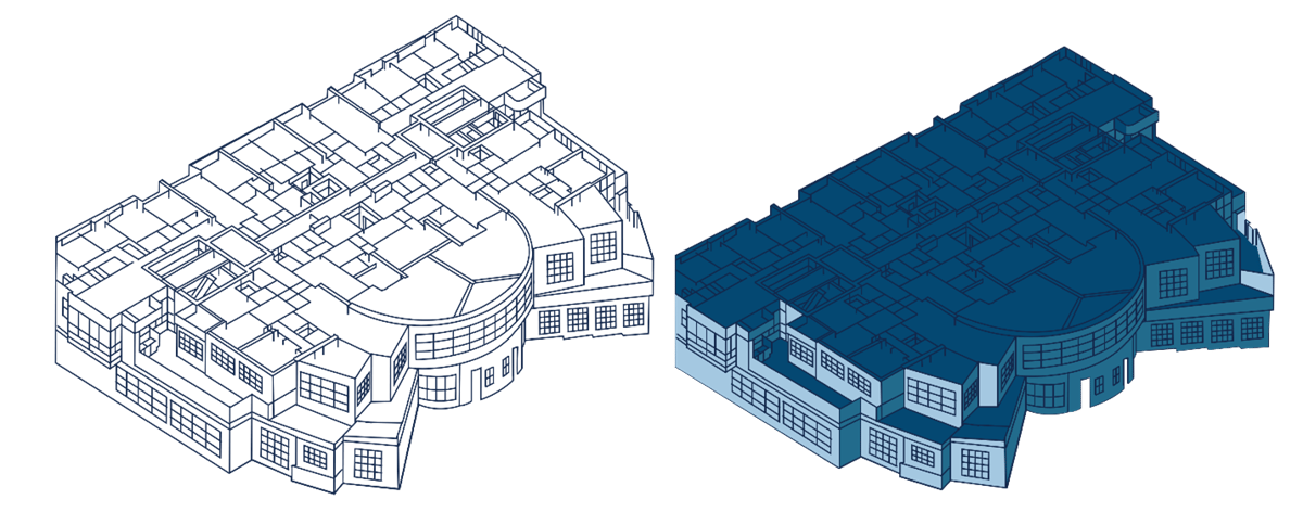
Figure 1
Already deployed by governments and municipalities, the web-based applications developed by Avineon provide users a city-wide view of building information in a secure environment, ultimately supporting analysis and value-based decision making with digital 3D models and plans.
With Avineon’s automated CAD to BIM to geo-enabled BIM process, users:
- Can ingest multiple CAD drawings with architectural elements, including floor/room space details.
- Can automate the development of BIM models with architectural elements at LOD 300.
- Can scale relevant models as needed across a region.
- Can geo-enable models over a landscape into a geodatabase.
- Have access to web-enabled GeoBIM data, publish as service, and spatial/engineering analytical tools.
While the use of CAD technology has transformed the design and drafting of buildings, BIM equips users with intelligent data models that can be analyzed for future planning and various other initiatives, such as efficiency, energy savings, and focused statistics. By integrating GIS, geo-enabled BIM enables viewing larger landscapes and the analysis of buildings in a smart, geo-enabled, environment:
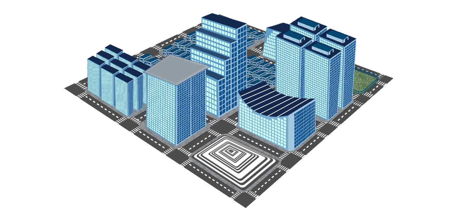
Figure 2
By making all BIM and GIS information available in one interface, stakeholders are able to manage their building projects along with other infrastructure data, enabling the analysis and reuse of information in various ways; incorporating both legacy buildings and an efficient new process to load new buildings to digital models through a modern template. Real-world, value-producing, applications of a geo-enabled BIM on the web include:
- A streamlined building permitting process
- Building code validations on legacy buildings
- Built-up area/volume vs. open and green space analysis
- Micro and macro building material statistics
- Building energy demand calculations over an area (heating/cooling) and solar potential calculation
- Floor space statistics (common areas, floor areas, layouts)
- 5G coverage planning
Avineon’s revolutionary method of converting complicated CAD drawings to BIM, and then integrating them with GIS, is an industry trendsetter that lowers the cost barrier of creating a geo-enabled BIM, ultimately unlocking the value to cities and municipalities that has been elusive to date.